The rapid advancement of digital tools has transformed how industries interpret, analyze and utilize geographic information. At the core of this transformation is the growing demand for mapping and data services that deliver accuracy, speed and real-time insights. These technologies have become essential across sectors such as construction, agriculture, public safety and environmental management. As organizations place higher value on spatial intelligence, the landscape of geospatial innovation continues to expand, opening new possibilities for automation and smarter decision-making.
How Intelligent Imaging Is Shaping Operational Efficiency
Imaging technologies have progressed far beyond traditional observation methods. With high-resolution sensors and automated capture systems, visual information can now be processed into detailed models, measurements and analytical layers. This shift allows teams to reduce the time spent on manual surveying while improving the quality of their assessments. As a result, businesses are able to work with greater precision and maintain continuity even in challenging or remote environments.
The Role of Automation in Enhancing Accuracy
Automation has become a crucial force behind improved geospatial workflows. Automated systems reduce human error, speed up data acquisition and maintain consistent quality across different conditions. The ability to generate standardized output also supports better long-term planning, especially for projects that require ongoing monitoring. Automation ensures that updates are timely, accurate and aligned with broader operational goals.

Improving Safety Through Remote Acquisition Methods
One of the most significant benefits of modern remote technologies is their contribution to safety. Workers no longer need to physically access hazardous or unstable environments for routine inspections. Remote systems can perform the same tasks more frequently and with enhanced detail. By minimizing exposure to danger and reducing the need for manual intervention, organizations can protect their teams while maintaining productivity.
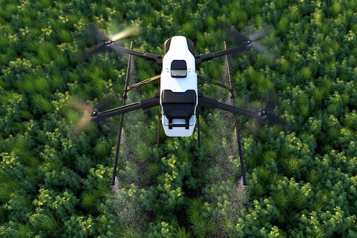
Enhancing Sustainability Through Smarter Resource Use
Sustainability is becoming increasingly important for industries worldwide. Advanced spatial technology supports eco-friendly practices by enabling better analysis of land, water and infrastructure. Through comprehensive insights, companies can make informed decisions that reduce waste, prevent environmental damage and optimize resource allocation. This contributes not only to operational savings but also to long-term ecological balance.
How Real-Time Insights Support Faster Decision-Making
The ability to access and interpret information in real time is a game-changer for many industries. Rapid insights make it possible to respond immediately to emerging challenges or opportunities. Whether monitoring growth patterns, assessing construction progress or evaluating environmental changes, the integration of real-time analysis ensures that leaders can make strategic decisions without delay. This modern approach replaces outdated, static methods with intelligent, actionable data.
Why Integration Across Digital Platforms Matters
As technology ecosystems grow, seamless integration becomes essential. When spatial information connects smoothly with planning software, monitoring tools or reporting dashboards, it enhances overall efficiency. Consolidated systems help eliminate redundancies, maintain consistent records and streamline communication across departments. This ensures that all stakeholders operate with the same accurate and updated information, which is vital for complex or long-term projects.
Preparing for the Next Wave of Geospatial Innovation
The next era of geospatial development is focused on scalability, automation and intelligent processing. As industries continue adopting advanced solutions, the demand for systems capable of handling large volumes of information will increase. Innovations in sensors, automation and remote capture will shape how organizations interact with geographic data. The emphasis will be on creating flexible, adaptable and future-ready solutions that support growth and long-term sustainability.

Conclusion
Geospatial technology is moving toward a future defined by automation, intelligence and seamless data integration. As the demand for advanced solutions grows, industries will continue to rely on powerful digital tools to enhance decision-making, improve safety and support sustainable development. The evolution of remote systems will play a major role in this progress, especially with innovations such as Drone in a box, which enable continuous, automated and efficient data collection. Together, these advancements are setting a new standard for modern spatial intelligence and shaping the way organizations understand and manage the world around them.
FAQs
What industries benefit the most from modern spatial technologies?
Industries such as agriculture, infrastructure, environmental management and public safety benefit greatly because they require frequent monitoring and accurate geographic information.
How does automation improve the quality of spatial insights?
Automation ensures consistent data capture, reduces human error and accelerates processing, resulting in more reliable and timely analysis.
Why is real-time information important for operations?
Real-time insights help organizations respond quickly to changes, make informed decisions and maintain operational efficiency without unnecessary delays.
How do advanced imaging methods support sustainability?
They provide detailed assessments that help companies manage natural resources wisely, reduce waste and prevent environmental disruptions.
What is the future outlook for geospatial technology?
The future centers on enhanced automation, increased scalability and intelligent data integration, allowing industries to operate with greater precision and flexibility.